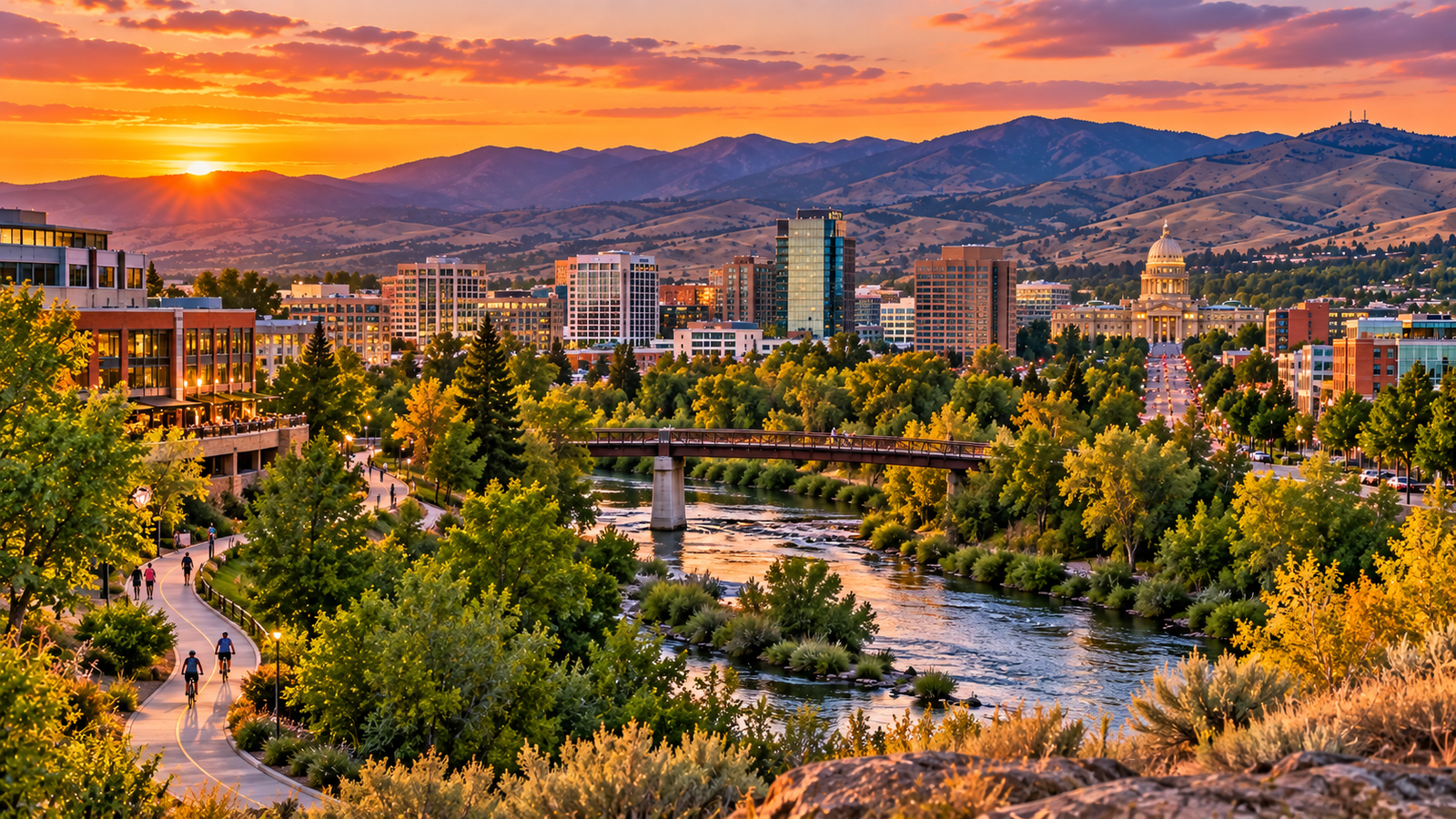
The Boise River Greenbelt is one of the easiest ways to understand Boise.
The pathway follows the Boise River through the city, connecting parks, neighborhoods, downtown, Boise State University, Garden City and Southeast Boise in a way that makes the river feel like part of everyday life rather than a separate attraction.
The City of Boise describes the Greenbelt as a 29-mile tree-lined pathway along the north and south sides of the Boise River.
You do not need to walk or bike all of it.
For most visitors, the best way to experience the Greenbelt is to choose one section, park once and spend an hour or two exploring.
This guide covers where to start, where to park, the best sections for first-time visitors, family-friendly areas, biking, etiquette, seasonal conditions and the Greenbelt stops most worth building into a Boise itinerary.
Boise Greenbelt at a Glance
The Boise River Greenbelt runs along both sides of the Boise River and connects many of the city's best-known riverside parks.
The route passes or connects with places such as:
Julia Davis Park
Ann Morrison Park
Kathryn Albertson Park
Esther Simplot Park
Boise Whitewater Park
Boise State University
Kristin Armstrong Municipal Park
Warm Springs
Marianne Williams Park
Parkcenter Park
Barber Park
Garden City
The official Boise Greenbelt map also divides the pathway into northwest, northeast, southwest and southeast quadrants with mile markers measured from the 8th Street pedestrian bridge.
That system can be useful when you are trying to describe your location or measure a ride.
Where Should First-Time Visitors Start?
If you have never been on the Greenbelt before, start near Julia Davis Park.
It is the easiest section to combine with the rest of a Boise trip.
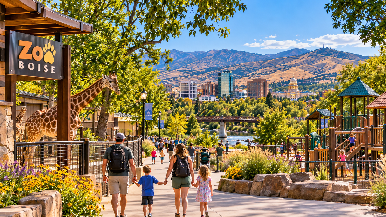
From there, you have access to Downtown Boise, Boise State University, Zoo Boise, Boise Art Museum, Idaho State Museum, the Idaho Anne Frank Human Rights Memorial, multiple pedestrian bridges, restaurants and coffee nearby.
You can walk east or west along the river without needing a complicated route.
For a first visit, this central section gives you the Greenbelt experience without making the Greenbelt the entire day.
Best Greenbelt Section for Downtown Visitors
The central stretch between Julia Davis Park, the 8th Street pedestrian bridge and Ann Morrison Park is especially good for visitors staying downtown.
It combines river views with easy access to Downtown Boise and several major parks.
If you are following our Ultimate Boise Visitor Guide, this is the section I would add first.
Julia Davis Park
Julia Davis Park is one of the most practical Greenbelt access points.
It sits directly along the river and places you beside several attractions.
That makes it ideal for visitors who want to combine the Greenbelt with museums or Zoo Boise.
You can walk west toward the Anne Frank Memorial and Ann Morrison Park or head east toward Boise State and the Warm Springs area.
There is enough going on around Julia Davis that families could spend several hours here without needing another part of town.
Boise State University Section
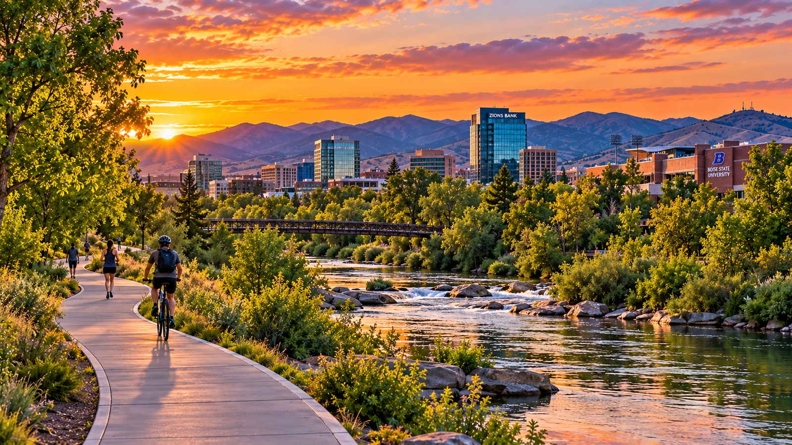
The Greenbelt runs alongside Boise State University.
This is one of the more active central sections, especially when classes are in session or Boise State events are happening.
It is a useful route if you want to see campus without driving around it.
You can combine Boise State, the Albertsons Stadium area, Julia Davis Park, downtown and riverfront walking or biking.
If you are doing our Weekend in Boise 2-Day Itinerary, this makes a good Sunday morning option.
Ann Morrison Park
Ann Morrison Park is another easy Greenbelt access point.
The large park sits south of the river and connects directly into the pathway network.
It works especially well if you want open park space rather than a downtown environment.
It is also close to Kathryn Albertson Park, making the area useful for a longer walk.
Kathryn Albertson Park
Kathryn Albertson Park is quieter than many of Boise's recreational parks.
The landscaped pathways, ponds and wildlife make it feel different from the busier downtown portions of the Greenbelt.
This is a good choice if your goal is walking, wildlife viewing, photography, a slower outing or fall colors.
It is also close enough to Ann Morrison Park that the two can be combined easily.
Esther Simplot Park and Boise Whitewater Park
West of downtown, the Greenbelt connects with Esther Simplot Park and Boise Whitewater Park.
This is one of the more recreation-heavy sections.
The area includes river access, ponds, open park space, Boise Whitewater Park, Greenbelt connections and nearby Garden City.
It is a good choice if you want something less urban than the Julia Davis section without leaving Boise.
Garden City Section
The Greenbelt continues through Garden City west of Boise.
This section feels somewhat different because you move between riverfront parks, residential areas, businesses and Garden City's growing collection of wineries, breweries and restaurants.
This can be a good choice for adults who want to combine a bike ride with food or drinks.
Warm Springs and East Boise
Heading east from downtown, the Greenbelt runs toward the Warm Springs area.
The official map identifies stops including Kristin Armstrong Municipal Park, Warm Springs Golf Course, Morrison Knudsen Nature Center and Marianne Williams Park.
This side of the Greenbelt becomes increasingly scenic and residential as you move away from downtown.
It also ties naturally into our Ultimate Guide to Boise's East End.
Southeast Boise and Parkcenter
Southeast Boise is one of the best areas for people who want a longer Greenbelt ride.
The route follows the river past neighborhoods, parks and Parkcenter Boulevard toward Barber Park.
This section feels less like downtown and more like a river corridor.
Good access points include Parkcenter Park, Baggley Park area, Bethine Church River Trail and Barber Park.
Our Ultimate Guide to Southeast Boise covers the surrounding neighborhood in more detail.
Barber Park
Barber Park is one of the eastern Greenbelt's most recognizable destinations.
It is also widely known as the traditional starting point for the Boise River float during the official float season.
The Greenbelt connection makes Barber Park useful even when you are not floating.
It gives walkers and cyclists another place to access the river corridor on the eastern side of Boise.
Best Greenbelt Section for Families
For families, I would start with one of three areas.
Julia Davis Park
Best if you also want Zoo Boise, museums or downtown.
Ann Morrison Park
Best if you want lots of open park space.
Esther Simplot Park
Best if you want water, recreation and room to spread out.
These areas also give you easy places to turn around if children lose interest.
You do not need to commit to a long point-to-point route.
Best Greenbelt Section for Bikes
Cyclists can comfortably cover much more of the Greenbelt than walkers.
A good first ride is Downtown Boise to Esther Simplot Park to Garden City and back.
Another strong option is Downtown Boise to Boise State to Parkcenter and back.
More ambitious riders can continue farther east or west.
How Long Is the Boise Greenbelt?
The City of Boise currently describes the Greenbelt as a 29-mile tree-lined pathway following both sides of the river through the city.
You may also encounter older maps or descriptions that use slightly different mileage figures.
That is because the pathway network has expanded over time and different sources may count different sections or jurisdictions.
For visitors, the exact total matters less than understanding that this is not one simple 29-mile line.
There are paths on both sides of the river, pedestrian-only portions, bridges and connections between jurisdictions.
Is the Greenbelt Paved?
Much of the Boise Greenbelt is paved.
However, not every section is.
The official Greenbelt map distinguishes between paved pathways, natural or dirt pathways and pathway sections outside Boise city limits.
One notable example is the Bethine Church River Trail, which is an unpaved pedestrian-only section.
If you are biking, pay attention to signs and stay on appropriate paved routes.
Boise Greenbelt Etiquette
The Greenbelt is a multi-use path.
That means walkers, runners, cyclists, people with dogs and other users are sharing the same space.
The City of Boise's current etiquette guidance includes several basic rules:
pedestrians have the right-of-way
stay on designated trails
cyclists should announce when passing
dogs must remain on a leash no longer than eight feet
wheeled users should travel at a safe speed
motorized vehicles and hooved animals are generally prohibited, with limited exceptions
non-paved Greenbelt sections are pedestrian-only
A simple "on your left" before passing someone on a bike goes a long way.
Is There a Speed Limit on the Greenbelt?
The City of Boise does not list a posted Greenbelt speed limit.
Instead, users on wheels are expected to maintain a speed that is safe for current conditions and the amount of traffic on the pathway.
That matters most in crowded areas near downtown, Boise State, major parks and pedestrian bridges.
A Greenbelt ride is not a race.
Slow down when the path gets busy.
Can You Bring Dogs on the Greenbelt?
Yes.
Dogs are allowed but must remain on a leash no longer than eight feet on Boise's Greenbelt.
Owners should also be particularly careful around bikes and narrow sections of path.
A long leash stretched across the Greenbelt is an easy way to cause a collision.
Are E-Bikes Allowed?
Rules involving electric bikes and other motorized devices can vary by jurisdiction and vehicle classification.
The Greenbelt crosses multiple jurisdictions, including Boise and Garden City, so users should check the current rules for the device they plan to ride.
If you are using a standard bicycle, the rules are much simpler.
When Is the Greenbelt Open?
The current City of Boise Greenbelt map states that the Greenbelt is open daily from sunrise to sunset.
For visitors, daytime use is also simply the better experience.
You can see the river, parks, wildlife and surrounding neighborhoods.
Greenbelt Safety
The Boise Greenbelt is heavily used, but normal urban safety habits still matter.
Useful habits include staying alert, limiting headphones when they prevent awareness, knowing your route, carrying a charged phone, choosing visible areas and avoiding isolated shortcuts.
The same advice applies to almost any long urban trail system.
Where to Park for the Boise Greenbelt
Parking depends on which section you want to explore.
Some of the easiest visitor access points are:
Julia Davis Park
Best for downtown access and first-time visitors.
Ann Morrison Park
Good for open space and central access.
Kathryn Albertson Park
Good for a quieter walk.
Esther Simplot Park
Good for recreation and western Greenbelt access.
Barber Park
Good for Southeast Boise and the eastern Greenbelt.
Parkcenter Area
Good for longer Southeast Boise rides.
Always follow posted parking restrictions.
Park lots may also become busier during events or peak river season.
Can You Access the Greenbelt From Downtown Boise?
Yes.
This is one of the Greenbelt's biggest advantages.
Downtown Boise sits only a short walk from the river.
Visitors can walk from downtown toward Julia Davis Park or the 8th Street pedestrian bridge and be on the Greenbelt without driving anywhere.
That makes the Greenbelt a natural addition to our Downtown Boise Guide.
If you are driving into downtown first, our Downtown Boise Parking Guide can help you choose a garage and explore the city on foot.
Can You Ride From Downtown to Garden City?
Yes.
The Greenbelt is one of the easiest ways to travel between central Boise and Garden City by bike.
From downtown, head west along the river toward Esther Simplot Park, Boise Whitewater Park and Garden City.
The ride lets you experience the river corridor without dealing with the same road traffic you would encounter on city streets.
Can You Ride From Downtown to Barber Park?
Yes.
Heading east, Greenbelt routes connect central Boise with Southeast Boise and Barber Park.
This is a considerably longer ride than simply circling the downtown parks, but it is a good option for visitors who actually want to make cycling part of the day's activity.
Bring water, check the weather and know how far you want to ride before you commit to the return trip.
Boise Greenbelt in Summer
Summer is the Greenbelt's busiest season.
Expect more cyclists, more runners, families, river float traffic, visitors around Barber Park, busy parks and warmer temperatures.
Morning is usually the most comfortable time for a longer ride during hot weather.
Shade from the river corridor helps, but Boise summer afternoons can still get hot.
Boise Greenbelt in Fall
Fall is one of the best times to use the Greenbelt.
Trees along the river corridor change color, temperatures become more comfortable and the pathway often feels completely different from summer.
Kathryn Albertson Park, Ann Morrison Park and the central river corridor are especially attractive during fall.
Our Best Places to See Fall Colors Near Boise includes additional fall ideas.
Boise Greenbelt in Winter
The Greenbelt does not disappear in winter.
Many sections remain useful for walking and recreation.
However, snow, ice, shaded areas and freezing temperatures can change surface conditions.
Do not assume that a clear downtown street means every Greenbelt section will be dry.
Conditions can vary considerably depending on shade and overnight temperatures.
Boise Greenbelt in Spring
Spring can be excellent for walking and biking.
Trees begin leafing out and temperatures are generally comfortable.
It is also a time when river levels may rise.
Stay on designated pathways and respect any closures or temporary detours.
Greenbelt Closures and Construction
The Greenbelt changes.
Bank repairs, bridge work, river projects, utility construction and new pathway connections can create temporary closures or detours.
Before planning a long point-to-point bike ride, check current City of Boise Greenbelt information.
A closure matters much less on a short park walk than it does when you are ten miles into a ride.
Boise River Float and the Greenbelt
The Greenbelt and Boise River float experience overlap, but they are not the same thing.
During the official float season, Barber Park is the common starting area and Ann Morrison Park is a common ending area.
The Greenbelt helps connect the parks and river corridor.
River floating conditions are seasonal.
Never assume the river is officially open for floating because the weather is warm.
Check current river and park guidance first.
Wildlife Along the Greenbelt
The Boise River corridor provides significant wildlife habitat.
Depending on the location and season, users may encounter ducks, geese, herons, songbirds, squirrels and other river wildlife.
Give wildlife space and do not leave the trail to chase a photograph.
Smoking and Vaping
Smoking and vaping are prohibited on the Greenbelt and in Boise city parks, except for limited designated areas in Julia Davis and Ann Morrison parks.
Visitors should treat the pathway as a smoke-free environment.
Best Greenbelt Route for a Short Walk
If you only have an hour, try Julia Davis Park to the 8th Street Footbridge to the Anne Frank Human Rights Memorial and back.
It gives you river views, downtown proximity, pedestrian bridges, park access and one of the most recognizable central Greenbelt stretches.
It also fits easily before lunch or dinner downtown.
Best Greenbelt Route for a Longer Walk
For something longer, try Julia Davis Park to Ann Morrison Park to Kathryn Albertson Park and back.
That gives you several different park environments without requiring a car between stops.
Best Greenbelt Route for a Casual Bike Ride
Try Downtown to Esther Simplot Park to Boise Whitewater Park to Garden City and back.
You get a mix of downtown, river corridor, recreation areas, parks and Garden City.
It is a much better introduction than trying to race through the entire Greenbelt.
Best Greenbelt Route for a Longer Ride
Try riding east from Downtown to Boise State to Parkcenter to Barber Park.
Then return when you have reached your preferred distance.
The exact mileage depends on where you start, which side of the river you use and which bridges you cross.
Use the official Greenbelt map and mile markers rather than relying only on a generic navigation app.
What Should You Bring?
For most outings, bring water, sunglasses, sunscreen, comfortable shoes, a phone and a bike helmet if cycling.
For a longer ride, add extra water, basic bike repair supplies, a route map and weather-appropriate layers.
There are plenty of urban areas near central sections of the Greenbelt, but farther stretches can feel considerably quieter.
Is the Greenbelt Worth Visiting?
Yes.
Especially if you are trying to understand Boise rather than just collect attractions.
The Greenbelt ties together much of what makes the city appealing: the Boise River, parks, neighborhoods, downtown, Boise State, outdoor recreation, wildlife, cycling and walkability.
It is not simply a trail running through Boise.
It is part of the way Boise is organized.
Combine the Greenbelt With a Boise Weekend
The Greenbelt fits particularly well into a short trip.
On a two-day visit, use Saturday morning for coffee, the Greenbelt, Julia Davis Park and downtown.
That keeps your itinerary compact and avoids unnecessary driving.
Our Weekend in Boise: 2-Day Itinerary lays out the full weekend.
Combine the Greenbelt With Southeast Boise
For a more local experience, head east toward Parkcenter and Barber Park.
This gives you a different perspective than the downtown Greenbelt sections.
Bown Crossing, Southeast Boise neighborhoods and river access can turn it into a half-day outing.
See our Ultimate Guide to Southeast Boise.
Combine the Greenbelt With Downtown Boise
If you are staying downtown, you may not need a car at all.
Walk from your hotel toward Julia Davis Park or the Anne Frank Memorial, spend an hour on the Greenbelt and then return downtown for lunch.
Our Best Restaurants in Downtown Boise can handle the food portion of the day.
The Bottom Line
The Boise River Greenbelt is one of the best ways to experience Boise because it connects so many parts of the city without feeling like a traditional tourist attraction.
Walk it. Bike it. Use it to reach a park. Follow it from downtown toward Garden City. Or spend a quiet morning along the river.
You do not have to cover 29 miles to understand why Boise residents value it.
For a first visit, start around Julia Davis Park.
For families, choose one of the major riverfront parks.
For cyclists, use the Greenbelt to explore farther east or west.
And for anyone visiting Boise, give yourself enough time to actually enjoy the river instead of treating the Greenbelt as another box to check.
This post may contain affiliate links. We may earn a commission when you purchase through links on this site at no additional cost to you.